 Weather system vendors are creating new tools designed to bring new elements into weather presentations, including real-time observation data and viewer videos of storm damage, as well as hooks into social media and mobile apps that let stations deliver weather information to viewers regardless of what screen they're viewing. This is the fifth in a series of articles appearing this week that collectively constitute a TVNewsCheck Special Report on Severe Weather News. The other stories in the series are below.
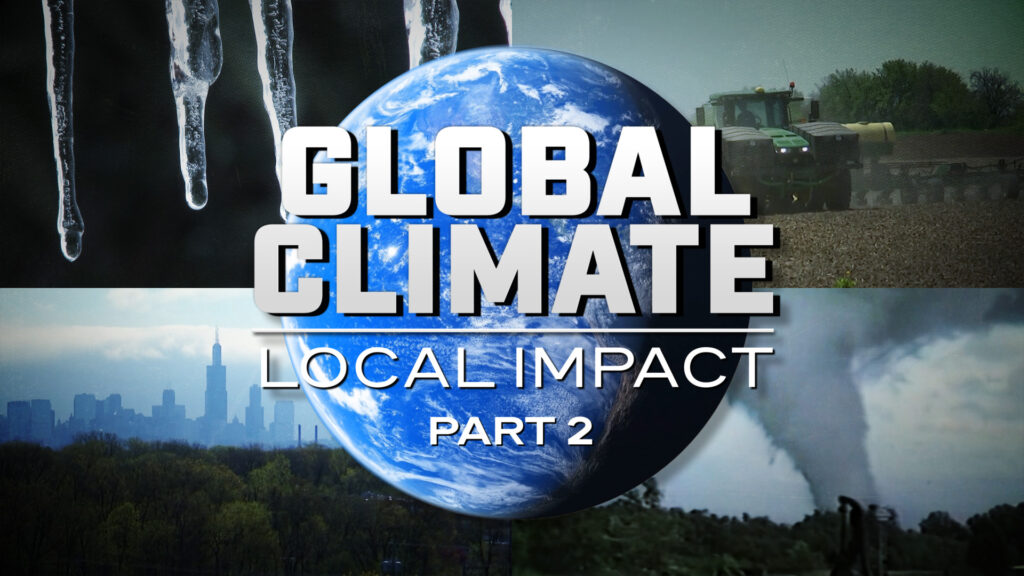
SPECIAL REPORT: SEVERE WEATHER
Weather Tech Keeps A Step Ahead Of Storms
A rash of severe weather this spring, including deadly tornadoes in Alabama in April and Missouri in May, has cast a brighter spotlight on stations’ crucial role in warning their viewers of dangerous weather and providing extended, sometimes round-the-clock, coverage in the aftermath of a storm.
And vendors of weather systems are stepping up with new tools designed to bring new elements into weather presentations, including real-time observation data and viewer videos of storm damage, as well as hooks into social media and mobile apps that allow stations to deliver weather information to viewers regardless of what screen they are viewing.
“Meteorologists are now challenged to do multiple shows and things simultaneously,” says Ardell Hill, president of broadcast operations for Huntsville, Ala.-based Baron Services.
“At the same time they’re preparing a forecast, they’ve got to make sure they’re posting it to the Web, putting it up on their Facebook page and putting things out on Twitter. Stations might also want updates for secondary programming, such as inserts in a digital subchannel.”
With that in mind, Baron’s new Omni 3 template-based weather graphics system allows the meteorologist to change one data point in a forecast, such as changing the outlook for Wednesday from cloudy to sunny in a seven-day forecast, and have the same data point automatically updated in multiple related graphics packages, such as a three-day or Web forecast.
“Once the meteorologist makes a change one time it now replicates across the entire system,” says Hill. “Previously that capability didn’t exist. You had to go update each screen individually.”
BRAND CONNECTIONS
Omni 3 also includes a Web scheduler tool, which has an unlimited supply of templates that can be set up to automatically publish weather pages using real-time data.
Baron is taking a similar approach to the mobile weather products it has under development. The company already provides an SMS-based weather alert system, SAF-T-NET, that lets stations send text messages to viewers’ cell phones to warn them of approaching severe weather.
“A lot of mobile apps are going to be tied to real, live data coming out of system,” says Hill. “That allows the meteorologist be more places at once.”
State College, Pa.-based AccuWeather was an early player in creating “on-deck” mobile weather services that wireless carriers sell to consumers on a subscription basis, and it still considers that a significant business. But over the past three or four years it has seen the momentum shift to “off-deck” apps such as those offered through Apple’s iTunes store, says AccuWeather VP of Marketing Lee Rainey.
AccuWeather is now on Version 4 of its iPhone app and was on the iPad the day it was announced, says Rainey. It now has close to 30 different apps for smartphones, including video forecasts, as well as its own mobile website. But the rapid growth in apps comes with new challenges.
“In the mobile world there are two ways to seek content on the mobile phone, either through an app or through a website with a browser,” notes Rainey. “The problem with apps is that there is not a lot of standardization in screen size or capabilities among the phones. So that is an area where is a lot of art and science. We will work with station groups helping to define those apps, and there might be six versions of an Android app to make.”
Andover, Mass.-based WSI Corp., part of The Weather Channel Cos., has developed a number of “white-label” smartphone applications that run on iPhones, iPads and Android phones.
Stations can use the apps to repurpose their weather content for mobile while maintaining their on-air brand, the same approach WSI takes with its Web products. The apps are generally offered for free and generate revenue from stations either through multiple ad placements or broader corporate sponsorships.
“The big thing for stations is to get their brand out over all platforms and provide a deeper, interactive weather experience,” says Jim Menard, GM of digital for WSI. “We’re trying to keep as much of the content, look and feel the same regardless of platform. So it looks the same on mobile, more or less, to what you see on the air.”
That said, the smartphone apps do provide an interactive map experience that uses different graphics from the on-air newscasts, although they are driven from the same data. And to take full advantage of the iPad tablet’s large screen, WSI wrote an entirely separate app from what it created for the iPhone and Android smartphones to deliver a richer graphic experience.
Madison, Wis.-based Weather Central has offered a WAP [Wireless Application Protocol]-based mobile product, Weather at Hand, for years. It has partnered with broadcaster-driven new media firms News Over Wireless and Inergize Digital to tackle the app market with two different products, WeatherNOW and News Synergy.
According to Bill Boss, VP of media product development and marketing for Weather Central, roughly 200 stations use Inergize’s News Synergy app, which offers general news and sports alongside Weather Central’s weather content. Both station-branded apps are free and ad-supported.
Weather Central is also close to rolling out a new iPhone app, Weather 360, which uses a combination of the phone’s GPS receiver and compass to identify local weather developments. It also integrates the phone’s camera, allowing users to immediately upload weather images to social networking sites.
“It’s a very simple app,” Boss says. “If you see a cloud over there, and it looks like it is raining, you can point the phone in that direction, click a button on the screen, and it will tell you how far away the rain is and if it is heading in your direction. It’s a simple, promotable app.”
Of course, while broadcasters are eagerly pursuing new platforms, they know the best way to maintain viewer loyalty is with accurate forecasts and in-depth coverage of severe weather such as thunderstorms, tornadoes, hurricanes and winter storms.
Thanks to faster processors in high-end workstations such as the HP Z800, all of the major graphics systems are now capable of updating graphics in real-time without having to wait for images to render as they did on the slower computers of the past. That allows meteorologists to be far more dynamic in pulling the latest observation data, such as live radar, into their on-air presentations.
Vendors are seeking to differentiate their storm-tracking and forecasting products with features that take advantage of new weather tools such as dual-polarization radar and real-time observations from hurricane-hunting planes.
They also are helping support extended coverage of severe weather events with new presentation tools such as interactive touchscreens, iPad-based remote controls and software hooks that make it easy to display user-generated content, such as viewer pictures or a Skype video call.
Baron, which is also a leading provider of radar systems for both the government and broadcasters, has sold its high-powered dual-polarization Doppler radars to nine TV stations as well as cable outlet BayNews9 in Tampa, Fla.
The radars, which give meteorologists a look inside a storm in both the horizontal and vertical planes, produce 100 times more data than conventional radars that work only in the horizontal plane, says Hill.
That is why the National Weather Service is upgrading its network of 171 NEXRAD radars to the dual-polarization technology, a job that Baron won back in 2009 and which it will be fulfilling over the next two years. Baron is currently working on some “unique visualization products” that will help take advantage of the enhanced data, Hill says.
“The meteorologist has a much stronger tool to tell them what they’re looking at and what’s out there, but they also have to learn how to interpret much more data coming at them,” he says.
Baron has also made some tweaks to its Omni 3 graphic product to help illustrate severe weather like hurricanes, including wave directions and windsocks that change their orientation to indicate the shifting winds when the eye of a hurricane passes overhead.
“A lot of the animation and graphics are tied to real-time data, so the image that’s displayed is, in fact, in synch with what the weather is actually doing,” says Hill.
Weather Central will be updating its graphics software to incorporate the new NEXRAD data. This fall, it will also introduce several improvements to its ESP:Live storm-tracking system, including a new method of depicting hurricane forecast tracks and the integration of Terminal Doppler Radar, which is used to detect hazardous wind shear conditions at major airports across the U.S.
Weather Central has also upgraded its 3D:LIVE Fusion graphics system with real-time rendering of complex 3D animations like clouds and fronts.
WSI has updated its TruVu Max Storm storm-tracking product to incorporate live sweeping radar and hail queries, which is helpful in identifying potential tornadoes.
“Tornadoes are often accompanied by hail, so getting advance warning of hail signatures is very important,” says Jim Brihan, director of media product management for WSI. “With HailTrax, we can see where the hail signatures are occurring based on radar returns.”
The Max Storm system can also analyze the vertical structure of a thunderstorm and look for the type of wind shear that makes tornado development likely.
“You get those markers to show up on the map automatically with our real-time rendering system,” says Brihan. “So the weather talent can be in the keywall and the image is updated in real-time without them having to do anything. They can be watching the situation unfold while they’re in the keywall.”
For a more interactive weather presentation, WSI has developed a touch-screen product in partnership with Perceptive Pixel, whose touch-screen panels are seen regularly on CNN for both weather and general news coverage. But most stations are content to use chroma-key technology with blue or green screens to generate their weather graphics, says Brihan.
“Part of what is driving that is the expense,” he says. “The cost of LCD monitors and the ability to do multi-touch is still pretty expensive. But with more competitors [in the touch-screen space], I think over time you will see more stations adopt that technology. The other thing about it is you have to do a really good job of lighting.”
AccuWeather is more bullish about the near-term adoption of touch-screen technology. The company last year introduced its Interactive TouchScreen as a dedicated weather product that allows meterologists to directly incorporate live HD and SD videos, images and Web content into their presentations in real-time.
The product, which is designed to work in conjunction with AccuWeather’s flagship CinemaLiveHD virtual-set product, uses hardware from Lumio and software and data from AccuWeather. It has a unique interface with thumbnails that depict available story elements, the ability to dynamically resize elements within the display, and full telestration capability. It also provides access to a library of AccuWeather informational videos and graphics for earthquakes, tsunamis and other natural disasters.
AccuWeather enhanced the product this year with modules to support sports, elections and general news stories, looking to broaden its footprint in the newsroom past the weather desk.
Rainey says the Interactive Touchscreen is attracting strong customer interest, particularly for its ability to bring in myriad elements during extended weather coverage. “For marathon coverage, the advantage of the TouchScreen is you can show live on-air websites or Skype sessions,” says Rainey. “With the thumbnail menu of elements, as you’re talking there, you know something new has arrived. You can decide how you want to introduce it in the presentation, and then can make that very fresh and live: ‘Here’s something just captured by phone,’ and you’ve got a new piece of footage. And you have not had to have any real [human] intervention to make that happen.”
Read other stories in this Severe Weather Special Report here.


Comments (11)
sajama national park says:
August 13, 2018 at 4:07 pm
Awesome article post.Thanks Again. Really Great.
Chuyen phat nhanh di Trung Quoc says:
August 17, 2018 at 1:57 am
“Wow! This blog looks just like my old one! It’s on a totally different subject but it has pretty much the same layout and design. Wonderful choice of colors!”
Strengthening Pelvic Muscles says:
August 17, 2018 at 8:29 am
Really informative blog article.Really thank you!
CCTV packages says:
August 17, 2018 at 10:17 pm
I loved your blog article.Thanks Again. Want more.
anal beads says:
August 18, 2018 at 7:47 am
I really enjoy the blog.Really thank you! Fantastic.
Betcity says:
August 19, 2018 at 1:24 am
Thanks for sharing, this is a fantastic blog article.Really thank you! Keep writing.
Sexy Lingerie says:
August 19, 2018 at 7:57 am
“wow, awesome article.”
clit suction toy says:
August 19, 2018 at 10:24 am
I really like and appreciate your blog article.Really looking forward to read more. Cool.
strap on review says:
August 20, 2018 at 12:03 am
Thank you ever so for you blog post.Much thanks again. Awesome.
End Of Lease Cleaning says:
August 21, 2018 at 8:44 am
wow, awesome article.Really thank you! Great.