At last month’s NAB Show in Las Vegas, one could see the new ATSC 3.0 broadcast standard (also known as NextGen TV) being used to deliver UHD video and interactive content to the latest 3.0-capable TV sets in several booths on the show floor. But in a private suite at the Wynn hotel, two very different 3.0 applications were being promoted by executives from BitPath, the joint venture formed by Sinclair Broadcast Group and Nexstar Media to pursue non-traditional revenues with the 3.0 spectrum.
BitPath was demonstrating NavPath, a 3.0-based system it has developed to improve the accuracy of location data, as well as an Internet of Things (IoT) solution that utilities could use to better communicate with customers and their IoT-capable devices during times of peak usage.
The more immediate opportunity appeared to be NavPath, which is aimed at the rapidly growing Positioning, Navigation and Timing (PNT) market. With the mass proliferation of smartphones, most consumers today are already regular users of location-based services that rely on the Global Positioning System (GPS) network of satellites. Put simply, GPS devices receive signals from these U.S.-government operated satellites and are able to measure the distance to the satellite by the time it takes to receive the signal, and then from that calculation they extrapolate the device’s own position.
Where GPS Misses The Mark

The BitPath Washington test car used to test its “rover” device on a route of 5-12 miles from both the base station and WIAV.
The wide availability of consumer GPS devices has enabled a bevy of services including both dedicated navigation systems like Garmin and mobile apps like Waze, recommendation and shopping apps such as Yelp and AroundMe, and ride-sharing services like Uber. But standard GPS only has an accuracy of about 3 to 10 meters, said BitPath President John Hane, due to factors including variations in weather, cluttered urban environments and occasionally anomalies in the satellites’ operations themselves.
Smartphones are able to compensate somewhat by using additional data points like Wi-Fi, but Wi-Fi doesn’t work on the highway. So, any regular user of a navigation app is familiar with the disparity between what the app indicates as your position and where your vehicle actually is, a disparity that may be enough to make you miss a turn on a highway with closely spaced exits.
A smartphone is “not a good GPS device,” Hane said, but with a powerful processor and very good analytics it can often seem better than it actually is.
“You see a pinpoint where you are, and you say I’ll just use this, because you’re familiar with it,” he said. “The Uber driver is a pinpoint, not a bubble, you’re a pinpoint, not a bubble, and he still goes to the wrong side of the street. It’s because your phone is compensating, it’s doing a lot of things.”
Industries that need more accurate position data such as surveying, construction and utility companies get better results today in several ways. First, they use more expensive GPS devices, starting at $2,000 and ranging up to $8,000 or more. And they correct for the dynamic inaccuracies in GPS on a second-by-second basis by employing a GPS base station, situated at a very precisely known location that doesn’t change, and mobile “rover” GPS receiver devices in the field (a technology known as Real Time Kinematics, or RTK).
 These improved systems use the base station to measure the current disparity between the GPS information that’s being received and their known location. They then transmit that correction data to the rovers over cellular networks, or over UHF spectrum (in the 450-470 MHz range) that they secure on a temporary basis, at a range of up to 30 kilometers (18.6 miles) or more.
The rovers are then able to use the same reference data indicating the current inaccuracy of the GPS signals to correct their own position, down to an accuracy as precise as 1-2 cm.
NavPath sends its correction data over the internet to a 3.0 station, which then transmits them over-the-air within the 3.0 signal to GPS rover devices throughout the market.
“Your rover is seeing the same satellites and the same atmospheric conditions, because it’s in the same market, and it’s calculating its location,” Hane explained. “But the base station is figuring out what its calculated location is over and over, many, many times a second. It’s constantly calculating its location based on what it’s receiving, but it knows where it really is. And so, it creates basically a differential correction — I’m 7 meters away on this vector. All you have to do is send that data to the rover. It’s a continuous stream of data — just like TV — and everybody in the same market needs the same data.”
Hane said that current high-precision GPS-correction solutions are very good, but they are either too expensive or too hard to scale, or both. And they don’t have long-term access to dedicated spectrum.
“We’re in a world where there is so much demand for this, and yet the devices are $8,000,” he said.
NavPath’s Opportunity
With the rapid growth in ride-sharing services and new public transit options like electric scooters and the continued development of autonomous electric vehicles (EVs) and drones, a better mass-market solution is needed — particularly when there isn’t always a human backstop to account for GPS errors. As such, a lot of investment is being directed toward the PNT space. Hane thinks broadcasters can use the 3.0 spectrum to play a key role with NavPath, which BitPath has been field testing in Washington, D.C., this spring using Sinclair’s low-power WIAV.
NavPath isn’t initially aimed at consumer devices, but instead at enterprise customers like utility companies that already use crews with sophisticated RTK systems to precisely map power anomalies and gas leaks. Like them, NavPath employs a GPS base station to calculate the inaccuracies. But instead of relying on cellular capacity or a temporary UHF channel, NavPath sends its correction data over the internet to a 3.0 station, which then transmits them over-the-air within the 3.0 signal to GPS rover devices throughout the market.
“The best thing about this from the business perspective is it’s a very small amount of capacity,” Hane said. “We can it sell once, and we don’t have to recover the whole cost, because we can sell it again to somebody else, and recover more costs. We can sell it for a third time and make a profit, and we can sell it a fourth time and begin to make more money.”
The Washington, D.C., Test
For the Washington tests, BitPath placed its base station in suburban Bethesda, Md., and used a passenger sedan to test its “rover” device on a route from Reagan National Airport to the Iwo Jima Memorial and back. The route was at a distance of 8 to 20 km (5 to 12 miles) from both the base station and WIAV.

The BitPath test data showed the uncorrected GPS track going off the road.
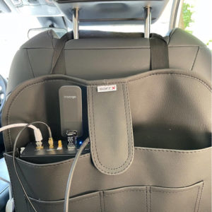
BitPath outfitted the car with both GPS and ATSC 3.0 antennas, along with a U-Blox GPS receiver and a Sony ATSC 3.0 receiver dongle. The NavPath rover also had an LTE dongle, so it could communicate position data back to the cloud for analysis, and the car had an onboard camera to record actual footage of its path.
BitPath brought examples of the base station and rover to Las Vegas. In addition to a presentation on the results, it was also able to show a live video feed of the test vehicle driving the route in D.C. along with the correlating GPS data.
“Other than the Sony piece here, this is all off-the-shelf hardware, very well known in the IoT and GPS space,” said BitPath COO Sasha Javid. “We’re trying to give people hardware that they’re familiar with, so they can visualize how they would commercialize this product in their own environment.”
The tests last month tracked the uncorrected GPS data received by the rover as well as the GPS position after it had been corrected with the reference data sent via the 3.0 signal, across a range of atmospheric conditions, topographical conditions and speeds. The goal was to gauge the “delta,” or difference, between the two sets of positions and see where the delta got bigger or smaller. The video recording could then be used to see how well the corrected GPS position compared to reality. BitPath also measured the signal-to-noise ratio of the 3.0 signal, similar to standard TV reception tests.
The test NavPath classified the delta in four categories that are indicated in color on a map of the route and described the potential route of an autonomous car relying solely on GPS data for navigation. Green showed a delta of 0 to 1 meter, indicating the GPS data was accurate; Blue was a delta of 1 to 2 meters, meaning the car would be drifting out of its lane; Purple was a delta of 2 to 3 meters, meaning the car would be in the wrong lane; and Red was a delta of 3 to 1,000 meters, meaning the car would be lost.
Looking at the color-coded map both in the presentation and in the real-time demo showed some long green stretches where there was little to no GPS correction needed, along with significant portions of the route that were purple or bright red. Javid said that NavPath on average was able to achieve an improvement of 2 to 3 meters over standard GPS.

The color codes show the range of inaccuracy of standard GPS on the BitPath test route.
He said the delta between the uncorrected and corrected GPS varied widely in testing depending on overhead clutter like bridges, overpasses and tree foliage that impacted the satellite signal, with the delta jumping above 10 meters in some places and the track of the uncorrected GPS going off the road. Meanwhile, WIAV’s 3.0 signal strength was good along the entire route.
“In one case the GPS data has the car off the road around a long loop, then puts him back on the road but on the wrong side,” said Javid. “That wouldn’t happen if you were a human driver, because you’re got common sense. But an autonomous car would have made that turn onto the wrong side of the road.”
More Testing Needed
While it had good initial results with one base station, going forward BitPath wants to figure out the effective range of the GPS differential data it is transmitting and whether it is still valid to the fringe of WIAV’s reception contour, which is some 60-70 km. If not, it may be necessary to place additional base stations throughout the market. The company is looking to partner with broadcasters to test NavPath in other markets this summer to gain more insight.
“Our goal is to do a bunch of field trials this summer, so when we are launching commercially, we know which applications we have the most competitive offering against the alternatives out there today,” Javid said. “What we do know for a fact is nothing can scale the way ours does and still deliver that sweet spot of accuracy. What we want to find out is what’s that range, how far can we go within our TV contour before we have to think about maybe another signal.”
The Distributed Energy Resources Market
Another “low-bandwidth, high-value” application that Hane and Javid are eyeing is IoT applications for the Distributed Energy Resources (DER) market. DER is where companies and consumers help meet the demand of the electric grid by installing and operating photovoltaic devices like solar panels that deliver electricity back to the grid, as well as by adjusting their use based on varying demand.

BitPath recorded the car’s travels on video to compare it to the location data it was pulling through the Internet.
The basic premise of DER is that no new power plants are being built in the U.S. or anywhere else, while at the same time the demand for electricity is steadily increasing. So, electric utilities are already implementing “demand response programs,” striking deals with large companies to throttle back their usage at peak times in exchange for a kickback or future discount.
“If you’re Google or you’re Facebook, you might turn up the temperature in your data center two degrees,” Javid said. “One small action, that in aggregate, enables the utility company to avoid hitting that peak demand.”
Currently, utilities are communicating those requests via SMS messages or even direct phone calls, but that doesn’t scale. What BitPath believes they would really like to do is to be able to ask their residential customers en masse to slightly turn up their Nest thermostat on a hot summer afternoon — or even tell EV owners to charge up their vehicles on a breezy day when wind turbines are pumping out surplus electricity. 3.0’s one-to-many architecture could be a cost-effective solution, perhaps in the form of home gateways that then communicate directly to IoT devices.
At the Wynn, BitPath developer Deva Seetharam demonstrated such an IoT application, using a DekTek modulator on a laptop to send a simulated 3.0 signal with demand-response messages to a Linux computer equipped with the Sony 3.0 receiver dongle. The Linux computer then broadcast the demand-response messages over Wi-Fi to an array of smart LED lights, turning them on and off.
“Utilities are looking for a better control and communication mechanism with consumers, so it’s more of a two-way grid, not a one-way grid,” Seetharam said. “They have to send the same message to multiple consumers at the same time, and it’s a very low data rate and very high value application.”


Comments (1)
SunnyAnd75 says:
May 20, 2022 at 2:16 pm
Another fine example of a solution looking for a problem…
Question- When was the last time you were with someone who said “Ahh! I wish my phone GPS was more accurate?”
Answer- Probably never
While I’m sure this technology over 3.0 works, what’s to prevent cellular companies from doing the same? They have the technology to triangulate on existing phones far better than 3.0 can- and they can do it today. Law Enforcement uses this technology to track users whereabouts (just watch any episode of Dateline over the past 10 years).
For 3.0 to succeed, we have to come up with some pretty compelling reasons for CONSUMERS to want it. Enhanced audio for consumers who never even wired up their 5.1 speakers in the first place is probably not the solution either. We have to think of the consumer.
Perhaps we can look at what we’re already doing best- Content. What if we presented ATSC 1.0 as “the new streaming technology that doesn’t require the internet” and start putting compelling content on our stations and promote our own over the air technology? Groups like Scripps and Weigel do a fantastic job in this space today. In addition, consumers want quality. ATSC 1.0, which is backwards compatible with every OTA set sold today, can do MPEG4, HEVC, 1080p, and even 4K! Even better, it works today! (I know, none of the 3.0 evangelists have told you this but yes, it’s true.)
I suggest as an industry that we begin to focus on content, making it stronger, and promoting it. We’re not in the data business and in the slim chance we actually come up with an idea, what’s to prevent Verizon from taking us off the map?